
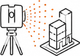
With 3D laser scanning, large amounts of detailed survey data can be captured quickly and with high precision. The result is a digital point cloud that represents the existing environment in three dimensions – creating a valuable source of data that can be used long after the survey itself has been completed.
Mätkonsult combines 3D scanning with traditional surveying, modelling and extensive experience from construction and civil engineering projects. This enables us to manage the entire process, from on-site data capture to completed deliverables for design, construction and documentation.
From reality to digital data
We scan everything from individual building elements to entire properties and complex industrial and construction environments.
Mätkonsult can assist with scanning of:
- existing buildings and premises
- façades
- industrial and installation environments
- structural frames and constructions
- office and residential properties
- groundworks and civil engineering environments
- existing conditions prior to renovation and refurbishment
- ongoing construction projects
The captured data is processed and adapted according to how it will be used in the project.
The point cloud – a digital representation of reality
With traditional surveying, the surveyor selects which points and objects are to be measured. Laser scanning works differently.
The scanner captures very large numbers of measurement points across the entire visible environment. Together, these points form a three-dimensional point cloud.
This provides an important advantage:
You don't always need to know today what you will need to measure tomorrow.
Because large parts of the environment are documented at the same time, information that was not specifically requested when the scanning was carried out can often be extracted from the point cloud later.
This makes scanning particularly valuable in projects where requirements change throughout the design and construction process.
From point cloud to Scan2BIM
A point cloud provides highly detailed survey data, but sometimes the information needs to be processed further.
Mätkonsult can process scanned data to create, for example:
- floor plans
- sections and elevations
- elevation documentation
- area calculations
- verification data
- 3D data
- models of existing buildings and structures
- IFC/BIM models
When the existing environment is modelled from the point cloud, a Scan2BIM model is created.
It can then be used together with the project's other digital models, providing designers, structural engineers and other stakeholders with a shared representation of the actual existing conditions.
Why use 3D scanning?
Capture large amounts of information in a single survey
Instead of measuring a limited number of selected points, large parts of the visible environment are documented.
Reduce the need for return visits
If additional dimensions or details are required later, the information can often be extracted directly from the point cloud.
Design based on actual conditions
In renovation and refurbishment projects, existing drawings are not always complete or up to date. Scanning provides current digital data based on what the building actually looks like.
Make complex environments measurable
Areas with dense installations, industrial environments, façades and complex structures can be documented much more comprehensively than with traditional point-by-point surveying alone.
One source of data for multiple stakeholders
The same point cloud can be used by architects, structural engineers, designers, contractors and Mätkonsult's own surveyors throughout different stages of the project.
Capturing millions of measurement points is easy. Turning them into the right information requires surveying expertise.
Mätkonsult sees scanning as an integral part of the overall surveying process. Our surveyors can combine laser scanning with traditional surveying and position the results within the project's coordinate and elevation systems.
We can then process the information further into the deliverables the project actually needs – from point clouds and drawings to survey data and completed 3D and BIM models.
Scan → position → process → model → deliver.
And because Mätkonsult also provides surveying services during the construction phase itself, the same data can continue to be used later in the project.
A scan is more than just a record of what something looked like at a particular point in time. When captured and positioned correctly, the information becomes a digital resource that can be used again and again throughout the project.
Capture reality once. Use it many times.
With Mätkonsult's 3D scanning and Scan2BIM services, you get accurate digital data – from reality to point cloud, drawing and model.